


Discover how modern positioning technology is revolutionizing precision across global industries through high-performance RTK systems.
Introduction to High-Precision Positioning
In the modern era of geospatial data, the demand for accuracy has transitioned from the scale of meters to the scale of centimeters. At the heart of this revolution is the RTK GNSS receiver. RTK, or Real-Time Kinematic, is a technique used to enhance the precision of position data derived from satellite-based positioning systems. While standard GNSS provides location data sufficient for general navigation, it is often plagued by atmospheric delays and orbital errors. An RTK GNSS receiver overcomes these limitations by using a fixed base station and a mobile rover to calculate corrections in real-time.
This guide serves as a comprehensive resource for professionals in surveying, precision agriculture, and autonomous systems. We will delve into the underlying physics of carrier-phase measurements, explore how different industries leverage this technology for efficiency, and provide expert advice on selecting the right hardware for your specific environmental challenges. As infrastructure becomes more complex and autonomous vehicles become a reality, understanding the capabilities of a modern RTK GNSS receiver is no longer optional for industry leaders—it is a fundamental requirement for operational success and safety.
The Technical Working Principles of an RTK GNSS receiver
To appreciate the power of an RTK GNSS receiver, one must understand the difference between code-based positioning and carrier-phase positioning. Standard GPS units measure the time it takes for a coded signal to travel from a satellite to a receiver. However, an RTK system measures the phase of the signal's carrier wave. Because the wavelength of the carrier signal is much shorter than the code bits, measuring the phase allows for much higher resolution. The primary challenge is the integer ambiguity problem—determining the exact number of full wavelengths between the satellite and the receiver.
The architecture of an RTK setup typically involves two main components: a Base Station and a Rover. The Base Station is set up on a known, surveyed point. It observes the same satellites as the Rover and calculates the difference between its known position and the position indicated by the satellite signals. These corrections are then transmitted to the mobile RTK GNSS receiver (the Rover) via a radio link or cellular network (NTRIP). The Rover applies these corrections to its own observations, effectively canceling out common-mode errors such as ionospheric interference and satellite clock biases. This process happens instantaneously, allowing the user to obtain centimeter-level coordinates while moving across a job site.
Furthermore, modern receivers utilize multi-constellation support. This means they do not rely solely on the US-based GPS, but also incorporate signals from Russia's GLONASS, Europe's Galileo, and China's BeiDou. By tracking more satellites, an RTK GNSS receiver can maintain a "Fixed" solution even in challenging environments like urban canyons or under moderate tree canopy. The transition from a "Float" solution to a "Fixed" solution is the hallmark of a high-quality receiver, representing the moment the system has successfully resolved the integer ambiguity and achieved its maximum rated accuracy.
Key Applications of RTK GNSS receiver Technology
The versatility of an RTK GNSS receiver has led to its adoption across a staggering array of professional fields. In the realm of land surveying and civil engineering, these devices have replaced traditional total stations for many tasks. Surveyors can now map large tracts of land in a fraction of the time, documenting topographic features, property boundaries, and construction stakes with absolute confidence. The ability to integrate GNSS data directly into CAD software streamlines the workflow from the field to the office, reducing human error and increasing project throughput.
Precision agriculture is another sector that has been fundamentally transformed. Tractors equipped with an RTK GNSS receiver can perform automated steering with pass-to-pass accuracy of less than 2.5 centimeters. This prevents overlap during planting or spraying, saving significant costs on fuel, seeds, and chemicals. Moreover, it allows for controlled traffic farming, where heavy machinery always follows the same tracks, reducing soil compaction and improving overall crop yields. In this context, the receiver is not just a tool for measurement but a critical component of a sustainable and profitable farming ecosystem.
Beyond traditional industries, the rise of Unmanned Aerial Vehicles (UAVs) and robotics has opened new frontiers. Professional drones utilize a compact RTK GNSS receiver to perform high-resolution photogrammetry and LiDAR mapping. Unlike standard drones that may drift several meters, RTK-enabled drones can fly precise grids and trigger cameras at exact coordinates. This is essential for bridge inspections, stockpile volume calculations, and environmental monitoring. Similarly, autonomous ground robots in logistics and mining rely on these receivers to navigate complex environments where safety and precision are paramount, ensuring that machines operate within their designated safety corridors at all times.
Essential Selection Tips for Your Next RTK GNSS receiver
Choosing the right RTK GNSS receiver requires more than just looking at the spec sheet. The first consideration should be the signal tracking capability. A future-proof receiver must support all major constellations (GPS, GLONASS, Galileo, BeiDou, QZSS) and multiple frequencies (L1, L2, L5). Multi-frequency support is crucial because it allows the receiver to better mitigate ionospheric errors and speeds up the time required to achieve a fixed solution, especially in "cold start" scenarios or after a signal loss under a bridge.
Environmental durability is the second pillar of selection. Fieldwork is often conducted in harsh conditions, from dusty construction sites to rainy agricultural fields. Ensure the RTK GNSS receiver has an IP67 or IP68 rating, meaning it is completely protected against dust and can withstand immersion in water. Shock resistance is equally important; a professional-grade unit should survive a 2-meter pole drop onto concrete. Additionally, check the battery life. In remote areas, you need a system that can operate for at least 10-12 hours on a single charge, or one that supports hot-swappable batteries to avoid downtime during critical observation windows.
Connectivity and software integration round out the selection criteria. A modern RTK GNSS receiver should offer various ways to receive correction data, including internal UHF radios for base-rover setups and 4G/LTE modems for network RTK (NTRIP). Bluetooth and Wi-Fi are essential for connecting to field controllers or tablets. Finally, consider the ecosystem of the manufacturer. Does the device play well with the software you already use? Is there reliable technical support? Choosing a brand that provides a complete solution—from the antenna to the post-processing software—can significantly reduce the learning curve and technical friction in your daily operations.
Innovative Solutions by Yonghao
When it comes to reliability and high-precision engineering, Yonghao stands at the forefront of the industry. As a dedicated provider of navigation and positioning technology, Yonghao offers a diverse range of products designed to meet the most demanding specifications. Whether you are looking for a standalone RTK GNSS receiver for land surveying or integrated modules for industrial automation, our portfolio is built on a foundation of accuracy and durability.
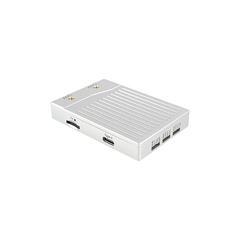
Our product line includes high-performance handheld units like the AP55 and the X10, which are engineered to deliver centimeter-level results in the most challenging terrains. For those specializing in unmanned systems, our RTK GNSS module series, including the UM982 and ZED-F9P based solutions, provide the perfect balance of small form factor and immense processing power. We also understand that signal integrity is paramount, which is why we offer specialized anti-jamming devices to protect your positioning data from intentional or accidental interference.
At Yonghao, we don't just sell hardware; we provide comprehensive support for your projects. From product customization to expert technical support, our team is committed to ensuring that your RTK GNSS receiver performs optimally throughout its lifecycle. With years of experience serving the agriculture, drone, and construction sectors, we have the expertise to help you navigate the complexities of modern positioning technology.
Conclusion
The RTK GNSS receiver has evolved from a niche tool for scientists into an indispensable asset for global industry. By providing real-time, centimeter-level accuracy, it empowers professionals to work faster, safer, and with unprecedented precision. As we look toward a future dominated by autonomous systems and smart infrastructure, the role of high-precision positioning will only grow in importance. By understanding the principles of RTK technology and selecting the right equipment from trusted partners like Yonghao, you can ensure that your operations remain at the cutting edge of efficiency and reliability.
Ready to elevate your precision?
Contact us today for a consultation or browse our full range of high-precision solutions.
Get Professional SupportFrequently Asked Questions
Q1: What is the maximum range for an RTK GNSS receiver from its base station?
Generally, a professional RTK GNSS receiver can maintain centimeter accuracy up to 10-20 kilometers from a local base station via UHF radio. If using a network-based RTK (NTRIP) via cellular data, the range can be extended further, provided there is a dense enough network of reference stations to provide accurate corrections.
Q2: How does an RTK GNSS receiver handle signal obstructions like trees?
Modern RTK GNSS receiver units use multi-constellation and multi-frequency tracking to mitigate signal loss. While heavy canopy can still cause a loss of "Fixed" solution, advanced algorithms and high-gain antennas help maintain a "Float" solution or quickly re-acquire a "Fixed" status once clearer sky is available.
Q3: Is an RTK GNSS receiver better than a standard GPS?
Yes, for professional applications. While a standard GPS offers accuracy within 2-5 meters, an RTK GNSS receiver provides accuracy within 1-2 centimeters. This makes RTK essential for tasks like construction staking, automated farming, and precise drone mapping where meter-level error is unacceptable.
Q4: Can an RTK GNSS receiver work without a cellular connection?
Absolutely. An RTK GNSS receiver can function perfectly without cellular signal by using a local Base and Rover setup connected via internal UHF radios. This is the preferred method for remote areas or deep valleys where mobile phone network coverage is unavailable.
Q5: How often should I calibrate my RTK GNSS receiver?
While the electronic components of an RTK GNSS receiver do not require daily calibration, you should perform a "check-shot" on a known survey monument before starting work each day. Additionally, the internal electronic bubble (IMU) and tilt sensors should be calibrated periodically according to the manufacturer's guidelines to ensure vertical accuracy.