


Advancing Modern Geodesy with Precision Technology
The evolution of land surveying has been fundamentally altered by the advent of Real-Time Kinematic (RTK) technology. In the current landscape of geospatial data collection, the use of an RTK GNSS receiver for surveying has become the industry standard for professionals seeking to achieve centimeter-level accuracy in real-time. Unlike traditional static GNSS methods that require extensive post-processing, RTK systems provide immediate positioning results by utilizing a base station and a rover that communicate through a data link. This allows surveyors to verify data quality on-site, significantly reducing the risk of errors and the need for costly return visits to the field.
Modern surveying demands more than just basic coordinates; it requires high-frequency updates, multi-constellation support, and robust performance in challenging environments. Whether conducting topographic mapping, construction stakeouts, or cadastral surveys, the integration of an RTK GNSS receiver for surveying ensures that every data point is captured with a high degree of confidence. By leveraging signals from GPS, GLONASS, Galileo, and Beidou, these receivers maintain a stable fix even under partial canopy or in urban canyons where satellite visibility might be restricted.
Deep Dive into RTK GNSS Receiver for Surveying Architecture
To understand the power of an RTK GNSS receiver for surveying, one must look at the underlying architecture that enables such high precision. At its core, the system relies on carrier-phase measurements rather than simple code-phase tracking. While standard GPS might offer meter-level accuracy, the RTK algorithm calculates the number of wavelengths between the satellite and the receiver to resolve the integer ambiguity. This process is facilitated by the base station, which remains at a known coordinate and transmits corrections to the rover.
A critical component of a modern RTK GNSS receiver for surveying is the GNSS module and the high-gain antenna. At Yonghao, we specialize in developing components that handle multi-frequency signals (L1, L2, and L5). These frequencies are essential for mitigating ionospheric delays and improving the "Time to First Fix" (TTFF). High-performance receivers now often incorporate Inertial Measurement Units (IMU) for tilt compensation. This allows the surveyor to capture accurate points even when the range pole is not perfectly vertical, which is a massive leap forward in field productivity and safety when measuring dangerous or hard-to-reach points.
Furthermore, the resilience of these systems against electronic interference is paramount. With the increasing density of radio signals in urban areas, anti-jamming capabilities have become a vital feature. Modern receivers utilize advanced filtering and multi-path reduction algorithms to ensure that the data captured remains "clean." This technical sophistication ensures that the surveyor can work through the day without losing a fixed solution, regardless of the surrounding electronic noise or physical obstructions.
Workflow Optimization in Field Operations
The primary benefit of deploying an RTK GNSS receiver for surveying is the dramatic optimization of project timelines. In the past, setting up a survey grid could take days of manual labor using total stations. Now, a single operator equipped with a rover can cover several hectares in a few hours. The workflow begins with the initialization of the base station or connecting to a NTRIP (Networked Transport of RTCM via Internet Protocol) service. Once the rover achieves a "fixed" status, the surveyor can begin high-speed data collection using a ruggedized field controller.
Workflow optimization also extends to the digital office. Data collected by the RTK GNSS receiver for surveying is typically stored in standard formats like CSV, DXF, or Shapefiles, which can be instantly synced to the cloud via 4G/5G connections. This means that while the field crew is still on-site, the engineering team in the office can begin analyzing the terrain or verifying the stakeout positions. This real-time collaboration eliminates the traditional bottleneck of physical data transfer and post-processing, allowing projects to move from the conceptual phase to construction much faster.
Moreover, the versatility of these receivers allows them to be integrated into various platforms. Beyond the handheld pole-mounted rover, the same high-precision GNSS modules are being used in Unmanned Aerial Vehicles (UAVs) and robotic mapping systems. This multi-platform capability means that a single investment in high-quality GNSS technology can serve multiple facets of a surveying business, from ground-level surveys to aerial photogrammetry, all while maintaining a consistent coordinate reference frame across the entire project.
Strategic Professional Insights and Field Solutions
Choosing the right RTK GNSS receiver for surveying requires a strategic understanding of the specific project requirements. For example, in precision agriculture, the focus is on pass-to-pass accuracy and long-term repeatability, whereas in construction, the emphasis is often on ruggedness and integration with BIM (Building Information Modeling) software. Surveyors should look for receivers that offer high ingress protection (IP67 or IP68) to withstand dust, water, and accidental drops, which are inevitable in field environments.
Another strategic consideration is the software ecosystem. A high-quality receiver is only as good as the software that controls it. Professionals should prioritize systems that offer intuitive interfaces, robust COGO (Coordinate Geometry) functions, and the ability to handle large CAD background maps without lag. The synergy between the hardware and software determines the user experience and, ultimately, the efficiency of the data collection process. At Yonghao, we emphasize the importance of a seamless interface between our GNSS modules and industry-leading field software.
Finally, technical support and customization are key pillars of a successful surveying operation. Many projects involve unique challenges that cannot be solved with "off-the-shelf" settings. Whether it is a custom coordinate system for a specific municipality or the need for a specialized antenna to improve signal reception in a particular region, having a partner who understands the nuances of GNSS technology is invaluable. Strategic field solutions involve not just the hardware, but the ongoing support and firmware updates that keep the equipment performing at its peak.
The Yonghao Edge: High-Precision GNSS Innovations
As a leader in the field of satellite navigation, Yonghao provides a comprehensive range of solutions tailored for high-accuracy applications. Our flagship RTK GNSS receiver for surveying models, such as the AP55 and the X10, are designed to meet the rigorous demands of professional land surveyors. These devices combine multi-frequency constellation tracking with advanced IMU tilt sensors, ensuring that accuracy is never compromised by field conditions.
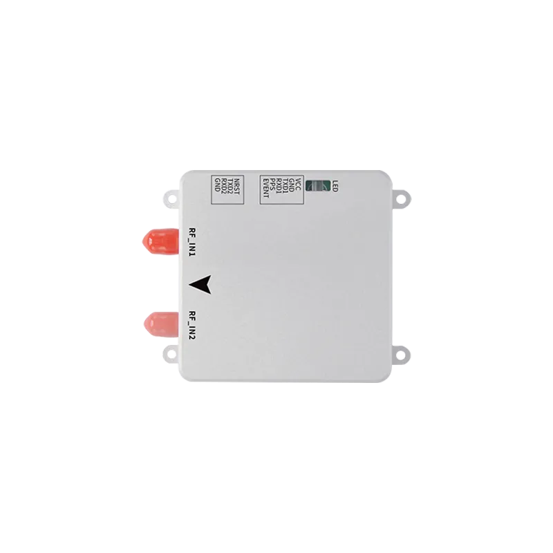
For developers and integrators, our high-precision modules like the UM982 and the ZED-F9P offer the same level of centimeter accuracy in a compact form factor. These are ideal for integration into drones or autonomous vehicles, where space is a premium but precision is mandatory. We also offer specialized RTK GNSS antennas to ensure optimal signal reception in any environment.
Our commitment to quality extends beyond simple positioning. We recognize the importance of signal security, which is why we have developed advanced anti-jamming devices to protect GNSS signals from intentional or accidental interference. With Yonghao technology, you are not just getting a receiver; you are getting a robust, reliable, and precise ecosystem designed to drive your projects forward.
Frequently Asked Questions
Q1: What is an RTK GNSS receiver for surveying?
An RTK GNSS receiver for surveying is a high-precision device that uses real-time kinematic technology to provide centimeter-level positioning by correcting satellite signals using data from a base station or network. It is essential for professional mapping and construction tasks.
Q2: How accurate is an RTK GNSS receiver for surveying?
When properly initialized and used within a reasonable baseline from a base station, an RTK GNSS receiver for surveying can achieve horizontal accuracy of 1cm + 1ppm and vertical accuracy of approximately 2cm + 1ppm.
Q3: What are the main components of an RTK GNSS receiver for surveying?
The primary components include a multi-frequency GNSS antenna, a high-performance GNSS engine or module, a data link (internal radio or cellular modem), and a field controller with surveying software.
Q4: Why choose an RTK GNSS receiver for surveying over traditional methods?
An RTK GNSS receiver for surveying offers significant time savings, allows for single-operator use, provides immediate results without post-processing, and maintains high precision over large project areas compared to total stations.
Q5: How do I maintain an RTK GNSS receiver for surveying?
Maintenance includes regular firmware updates, ensuring the battery contacts are clean, checking the antenna cables for wear, and periodic calibration of the internal sensors like the IMU for tilt compensation.
Conclusion
In the competitive world of land surveying and geospatial engineering, the tools you choose define your success. An RTK GNSS receiver for surveying is not merely an instrument; it is the cornerstone of accuracy and efficiency in the field. By choosing Yonghao, you are partnering with a pioneer in high-precision technology that understands the demands of the modern surveyor. Elevate your data collection capabilities today.