


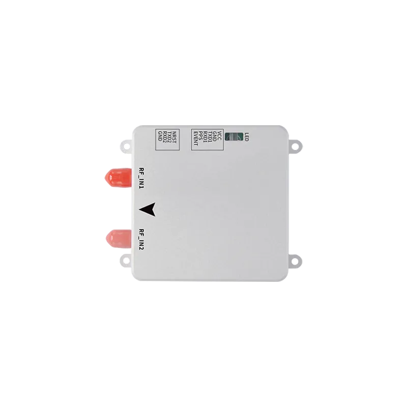
An in-depth guide on implementing centimeter-level positioning for autonomous platforms and smart robotic systems.
Introduction to precision in modern robotics
The landscape of autonomous technology has shifted dramatically with the integration of high-precision positioning. In the early days of mobile robotics, standard satellite navigation was often sufficient for general location awareness, but it lacked the granularity required for complex tasks. Today, GPS GNSS RTK for robotics navigation systems has become the gold standard for achieving centimeter-level accuracy. RTK, which stands for Real-Time Kinematic, uses a technique that measures the phase of the signal carrier wave rather than just the information content of the signal. This allows robots to understand their position within a tiny margin of error, enabling them to perform delicate operations such as precision farming, automated lawn mowing, and intricate last-mile delivery. Without this level of precision, robots remain limited to controlled environments or rely heavily on expensive and computationally heavy vision-based sensors.
By leveraging corrections from a base station or a network of stations, GPS GNSS RTK for robotics navigation systems overcomes the atmospheric delays and clock errors that typically plague standard GPS receivers. This technical leap ensures that whether a robot is navigating a vineyard in rural areas or moving through an industrial park, its path remains consistent and repeatable. As we explore the intricacies of this technology, it becomes clear that the marriage of GNSS and RTK corrections is not just an upgrade but a necessity for the next generation of autonomous machinery. This article will break down how these systems function, the tangible benefits they offer to various industries, and the technical hurdles engineers must overcome during integration.
Technical deep dive into RTK mechanics
Understanding how GPS GNSS RTK for robotics navigation systems works requires a look into the carrier-phase measurement process. Standard GNSS receivers use the code transmitted by satellites to determine location, which typically results in an accuracy of three to five meters. In contrast, RTK receivers analyze the phase of the carrier signal itself. Because the wavelength of the carrier signal is much shorter than the code bits, measuring its phase allows for much higher resolution. However, this process introduces the challenge of integer ambiguity—determining exactly how many full wavelengths exist between the satellite and the receiver. High-performance modules, like those developed by Yonghao, utilize advanced algorithms to solve this ambiguity rapidly, often referred to as "fixing" the position.
The system architecture generally involves a rover (the robot) and a base station. The base station is placed at a known, surveyed location and monitors the same satellites as the rover. Because the base station knows its exact coordinates, it can calculate the difference between its measured position and its true position. These corrections are then transmitted in real-time to the robot via a radio link or cellular network using protocols like RTCM. The integration of GPS GNSS RTK for robotics navigation systems into the robot’s controller allows it to apply these corrections instantly, refining its spatial coordinates to within 1-2 centimeters. This dual-frequency approach, often utilizing L1 and L2 or L5 bands, further enhances reliability by reducing the time required to achieve a fixed solution and improving performance under challenging canopy or environmental conditions.
Quantifiable benefits for autonomous platforms
The primary advantage of implementing GPS GNSS RTK for robotics navigation systems is the elimination of drift and the achievement of repeatable accuracy. For a robotic lawnmower, this means the ability to cut in perfect straight lines without overlapping or missing spots, which significantly reduces energy consumption and wear on the mechanical components. In the field of precision agriculture, RTK-enabled tractors and drones can apply fertilizers or pesticides with surgical precision, ensuring that only the intended plants are treated. This efficiency directly translates to a higher ROI for operators, as resource waste is minimized. Furthermore, the high update rates of modern RTK modules (often 10Hz or 20Hz) provide the low-latency data necessary for high-speed robotic movement.
Safety is another critical factor where GPS GNSS RTK for robotics navigation systems proves invaluable. In environments where robots operate near humans or expensive infrastructure, knowing the exact location of the machine is paramount for collision avoidance. Standard GPS might place a robot on a sidewalk when it is actually on the road; RTK ensures the robot knows precisely which side of the curb it is on. Additionally, the multi-constellation support (including GPS, GLONASS, Galileo, and Beidou) found in professional-grade RTK systems ensures that even if one satellite network is partially obstructed, the robot can maintain its high-precision fix by utilizing signals from other available constellations. This redundancy is essential for mission-critical applications where downtime is not an option.
Overcoming integration and environmental hurdles
While the benefits are clear, integrating GPS GNSS RTK for robotics navigation systems is not without its difficulties. One of the most significant challenges is signal multipath, which occurs when satellite signals reflect off buildings, trees, or the ground before reaching the antenna. In dense urban environments, these reflections can cause errors that are difficult for the receiver to filter out. To combat this, engineers must select high-quality antennas with strong multi-path rejection capabilities and place them in optimal positions on the robot chassis. Furthermore, the reliance on a correction link means that if the radio or cellular connection between the base and the rover is interrupted, the system may lose its "fix" and revert to a less accurate "float" or "standalone" mode.
Another hurdle is the synchronization between the GNSS data and other onboard sensors like IMUs (Inertial Measurement Units) or Lidars. While GPS GNSS RTK for robotics navigation systems provides excellent absolute positioning, it may not always provide the high-frequency orientation or "heading" data needed for rapid maneuvers. This is why many advanced systems use "GNSS+INS" fusion, where the RTK data constrains the drift of the IMU, and the IMU fills in the gaps during short GNSS outages (such as when a robot passes under a bridge). Managing the power consumption of these high-performance modules is also a consideration for battery-operated robots, requiring a balance between processing power and operational longevity.
Why choose Yonghao for your navigation needs
At Yonghao, we specialize in providing cutting-edge satellite navigation solutions tailored for the most demanding autonomous applications. Our expertise in GPS GNSS RTK for robotics navigation systems allows us to manufacture components that deliver unwavering precision even in complex environments. We understand that every robotic platform has unique requirements, which is why we offer a diverse range of hardware, from integrated antennas to multi-frequency modules. Our commitment to quality ensures that your autonomous systems can operate with the reliability required for commercial and industrial success.
Our product lineup includes the highly acclaimed ZED-F9P RTK GNSS module, which is specifically designed for robotic lawnmowers and UAVs. For those seeking all-in-one solutions, the YHRTK-980 module provides multi-constellation support in a compact form factor. We also offer specialized RTK GNSS antennas that are optimized for high-gain and multi-path mitigation. By choosing Yonghao, you are partnering with a leader in the field dedicated to pushing the boundaries of what is possible in autonomous navigation. Explore our full range of GNSS products to find the perfect fit for your next project.
Frequently asked questions
How accurate is GPS GNSS RTK for robotics navigation systems compared to standard GPS?
Standard GPS typically provides an accuracy range of 3 to 5 meters due to atmospheric distortions. In contrast, GPS GNSS RTK for robotics navigation systems achieves centimeter-level precision, usually within 1-2 centimeters. This is made possible by processing the carrier phase of the satellite signal and applying real-time corrections from a base station, making it essential for tasks requiring high spatial resolution.
Does GPS GNSS RTK for robotics navigation systems require a constant internet connection?
It depends on the correction source. If the system uses NTRIP (Network RTK), a cellular or internet connection is required to receive corrections from a service provider. However, if the robot is paired with its own local base station, they can communicate via long-range (LoRa) radio or other RF links, allowing GPS GNSS RTK for robotics navigation systems to operate in remote areas without internet coverage.
Can GPS GNSS RTK for robotics navigation systems work under heavy tree cover?
Dense foliage can attenuate satellite signals and cause multipath errors, which may interfere with the RTK "fix." However, professional GPS GNSS RTK for robotics navigation systems from Yonghao utilize multi-band and multi-constellation technology (GPS, Beidou, Galileo, GLONASS) to maximize signal availability and maintain high precision even in partially obstructed environments.
What is the typical "time to first fix" for GPS GNSS RTK for robotics navigation systems?
Modern high-performance RTK modules can achieve a "cold start" fix in under 30-60 seconds and a "hot start" fix in just a few seconds. The time required for GPS GNSS RTK for robotics navigation systems to move from a standard solution to a centimeter-accurate "fixed" solution depends on the number of visible satellites and the quality of the correction data.
How does Yonghao support the integration of GPS GNSS RTK for robotics navigation systems?
Yonghao provides comprehensive technical documentation, evaluation boards, and expert support to help engineers integrate GPS GNSS RTK for robotics navigation systems into their platforms. We offer customized antenna designs and firmware tuning to ensure that our modules perform optimally within the specific mechanical and electrical constraints of your robot.
Elevate your autonomous systems today
The transition to high-precision navigation is the key to unlocking the full potential of your robotics projects. Whether you are building drones, tractors, or delivery robots, RTK is the technology that makes it possible.