


An expert guide into the core positioning technology driving the future of self-driving systems and intelligent robotics.
Understanding the role of GNSS in modern autonomy
The evolution of self-driving technology relies heavily on the ability of a vehicle to determine its exact location within a global coordinate system. A high-performance GPS receiver for autonomous vehicles serves as the primary source of absolute positioning, providing the necessary data to navigate complex environments. Unlike standard automotive navigation systems that offer meter-level accuracy, autonomous systems require centimeter-level precision to ensure the vehicle remains within its designated lane and reacts correctly to infrastructure.
Reliability in these systems is not just about staying on the road; it is about functional safety. For a GPS receiver for autonomous vehicles to be considered flight-ready or road-ready, it must handle challenging signal conditions, such as urban canyons, tunnels, and dense foliage. By integrating multi-constellation support—including GPS, BDS, GLONASS, and GALILEO—modern receivers ensure that even if one satellite network is obstructed, others maintain the positioning lock. This redundancy is the cornerstone of modern GNSS architecture in high-stakes automation.
At Yonghao, we understand that the transition from assisted driving to full autonomy requires a leap in hardware capabilities. The integration of high-sensitivity RF front-ends and advanced digital signal processing allows our modules to filter out noise and multipath interference, ensuring that the navigation engine receives the purest data possible for real-time decision-making.
The mechanics of high-precision RTK positioning
Real-time kinematic (RTK) technology has transformed the capabilities of a GPS receiver for autonomous vehicles. By utilizing a network of base stations or a single reference station, RTK corrects common GNSS errors caused by ionospheric delays and satellite clock offsets. This process involves comparing the phase of the satellite's carrier wave to the phase at a known location, resulting in a positioning solution that is accurate to within 1-2 centimeters. This level of detail is vital for tasks like robotic lawn mowing, agricultural automation, and urban shuttle services.
To achieve this, the receiver must be capable of processing multi-frequency signals (such as L1, L2, and L5). Multi-frequency support significantly reduces the time to first fix (TTFF) and improves the robustness of the position fix in environments where signals might bounce off buildings. A professional GPS receiver for autonomous vehicles must also incorporate advanced algorithms to handle carrier-phase ambiguities, ensuring that the "fixed" solution remains stable even during high-speed maneuvers.
Furthermore, the hardware design plays a critical role. Yonghao utilizes low-noise amplifiers and high-rejection filters to protect the GNSS signal from electromagnetic interference (EMI) generated by the vehicle's other electronic components. This holistic approach to hardware and software ensures that the positioning data remains consistent, which is the foundation of trust in any autonomous system.
Sensor fusion: Integrating GNSS with IMU and Lidar
While a GPS receiver for autonomous vehicles provides excellent absolute positioning, it is rarely the only sensor on board. To achieve truly safe navigation, engineers employ sensor fusion, combining GNSS data with inertial measurement units (IMU), Lidar, and cameras. The IMU provides dead reckoning capabilities, filling in the gaps when the GNSS signal is temporarily lost, such as when passing under a bridge or through a short tunnel. This integrated navigation system (INS) provides a continuous stream of position, velocity, and attitude (PVA) data.
The synergy between these sensors allows the autonomous system to cross-verify data. For instance, if the GNSS indicates a sudden jump in position due to multipath error, the IMU and Lidar can identify this as an anomaly and maintain the vehicle's trajectory based on physical motion models and environmental mapping. This layer of verification is essential for meeting industry standards like ISO 26262, which governs functional safety in automotive electrical and electronic systems.
Yonghao specialized modules, such as our high-precision heading series, are designed specifically to work within these fused architectures. By providing dual-antenna inputs, our receivers can determine the vehicle's heading (orientation) accurately even when the vehicle is stationary. This is a significant advantage over single-antenna systems that require movement to calculate a heading, making our solutions ideal for complex robotic startups and industrial autonomous platforms.
Overcoming the urban canyon challenge
Operating an autonomous vehicle in a dense city environment is perhaps the greatest challenge for GNSS technology. High-rise buildings block direct lines of sight to satellites and cause signals to reflect, leading to significant positioning errors. A robust GPS receiver for autonomous vehicles must employ sophisticated multipath mitigation techniques. This involves using correlation algorithms that can distinguish between the direct signal and its reflections, ensuring the integrity of the calculated position.
Beyond multipath, signal interference from cellular towers and other radio sources can jam GNSS frequencies. Yonghao addresses this through our advanced anti-jamming technologies. By implementing spatial filtering and digital interference suppression, our receivers can maintain operation in "noisy" RF environments that would typically cause standard consumer-grade receivers to fail. This ensures that autonomous delivery robots and city taxis remain operational and safe regardless of their surroundings.
Additionally, the use of GNSS correction services transmitted via internet (NTRIP) or satellite (L-Band) provides the GPS receiver for autonomous vehicles with the constant stream of data required to maintain RTK precision. Our modules are optimized for low latency in processing these corrections, ensuring that the "real-time" in Real-Time Kinematic is strictly maintained for high-speed road applications.
Yonghao: Leading the way in GNSS innovation
Yonghao is at the forefront of positioning technology, providing high-performance solutions tailored for the most demanding applications. Our commitment to excellence is reflected in our diverse product lineup, designed to meet the specific needs of the autonomous industry. Whether you are developing a UAV, a robotic mower, or a full-scale self-driving car, we provide the hardware that makes precision possible.
Our core strength lies in our ability to integrate multiple satellite constellations and frequencies into compact, power-efficient modules. We offer a range of products including:
- High-precision modules: Such as the UM980 and ZED-F9P, which offer centimeter-level GPS receiver for autonomous vehicles capabilities.
- Dual-frequency heading solutions: Like the UM982, providing both position and precise orientation.
- Anti-jamming systems: Our eight-channel anti-jamming terminals ensure stability in contested environments.
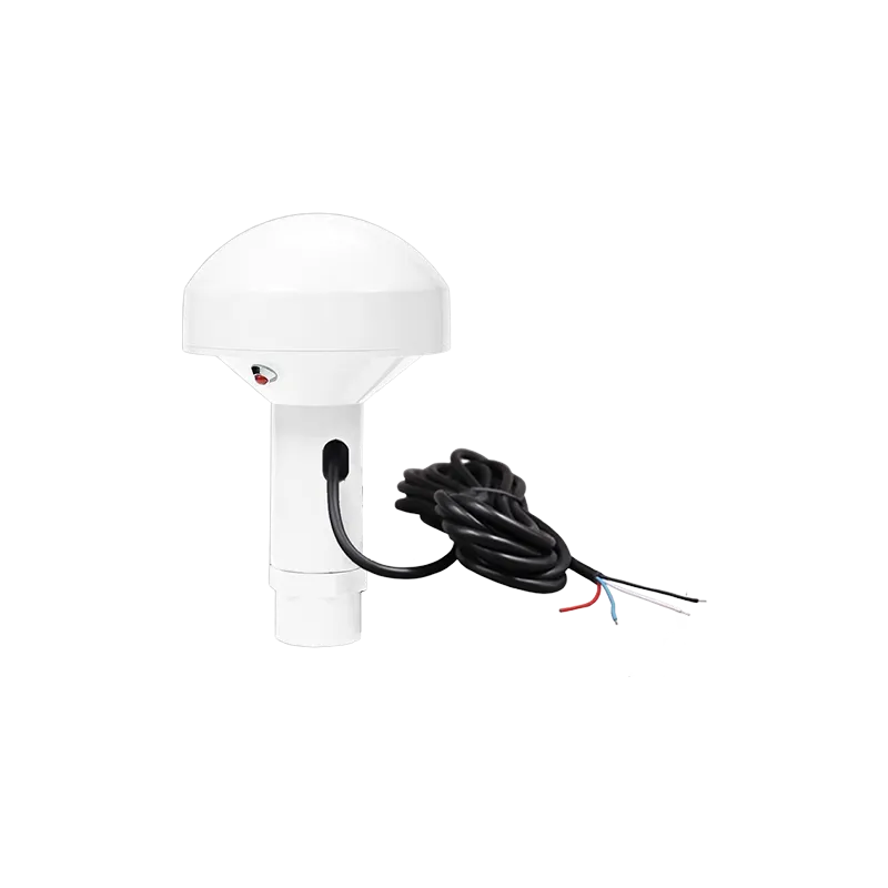
- Integrated antennas: High-gain RTK GNSS antennas designed for maximum signal reception.
Choosing Yonghao means partnering with a team that values technical support and product customization. We work closely with our clients to ensure that every GPS receiver for autonomous vehicles we supply is perfectly tuned to its intended operational environment.
Conclusion: The future of autonomous navigation
As the world moves toward a future of ubiquitous automation, the importance of reliable positioning cannot be overstated. A high-quality GPS receiver for autonomous vehicles is not just a sensor; it is the fundamental framework upon which safety and efficiency are built. By embracing RTK technology, multi-constellation support, and robust anti-jamming measures, manufacturers can ensure their vehicles operate with the highest degree of confidence.
The journey toward full autonomy is complex, but with the right positioning partners, the destination is within reach. Yonghao remains dedicated to pushing the boundaries of what is possible in GNSS technology, ensuring that your autonomous systems are always exactly where they need to be.
Frequently asked questions
Q1: What accuracy can a GPS receiver for autonomous vehicles achieve?
A professional grade receiver, especially when utilizing RTK (Real-Time Kinematic) corrections, can achieve centimeter-level accuracy (typically 1-2 cm). Yonghao high-precision modules are designed specifically to maintain this accuracy across various challenging terrains.
Q2: Why is multi-frequency support important for a GPS receiver for autonomous vehicles?
Multi-frequency support (L1, L2, L5) allows the receiver to correct for atmospheric delays more effectively and provides faster convergence times for RTK. It also improves reliability in urban areas where signal obstructions are common, a feature standard in Yonghao advanced GNSS products.
Q3: How does a GPS receiver for autonomous vehicles handle signal loss in tunnels?
In cases of signal loss, the system relies on sensor fusion. The receiver works in tandem with an IMU (Inertial Measurement Unit) to perform dead reckoning. Yonghao modules are designed to integrate seamlessly with these sensors to provide continuous positioning data even without a satellite fix.
Q4: Can a Yonghao GPS receiver for autonomous vehicles resist signal jamming?
Yes, Yonghao offers specialized anti-jamming terminals and modules that use digital filtering and spatial processing to suppress interference. This ensures that the autonomous vehicle remains operational even in environments with significant radio frequency noise or intentional jamming.
Q5: What makes Yonghao a preferred supplier for an autonomous vehicle positioning system?
Yonghao combines years of expertise in GNSS research with a robust production line. We offer high-precision, industrial-grade hardware that supports all major global constellations, backed by professional technical support to help integrate our GPS receiver for autonomous vehicles into your specific platform.