


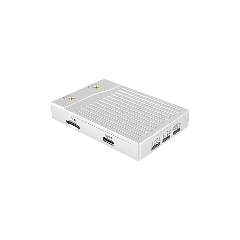
A comprehensive guide to understanding centimeter-level satellite navigation and its transformative impact on modern industry.
Introduction to High-Precision Navigation
In the rapidly evolving landscape of geospatial technology, the demand for high-fidelity location data has never been higher. Standard GPS systems, while sufficient for general consumer navigation, often fall short when tasks require accuracy within a few centimeters. This is where the RTK GNSS receiver for precise positioning becomes an essential tool. Real-Time Kinematic (RTK) technology enhances the signals from Global Navigation Satellite Systems (GNSS) by using a fixed base station and a mobile rover to correct errors in real-time. This methodology allows professionals in various sectors to move beyond the limitations of traditional meter-level accuracy, enabling a new era of automation and scientific measurement.
The core advantage of using an RTK GNSS receiver for precise positioning lies in its ability to mitigate common satellite signal errors, such as atmospheric delays and orbital discrepancies. By processing the carrier phase of the satellite signal rather than just the code information, these receivers achieve a level of precision that was once only possible through lengthy post-processing workflows. Today, with the integration of multi-constellation support including GPS, GLONASS, Galileo, and BeiDou, these systems offer robust performance even in challenging environments. As we delve deeper into this guide, we will explore the underlying mechanisms and the critical factors that ensure the reliability of these high-precision instruments.
The Fundamentals of RTK GNSS Receiver for Precise Positioning
To understand how an RTK GNSS receiver for precise positioning operates, one must first grasp the concept of differential correction. Standard GNSS positioning relies on the time it takes for a signal to travel from a satellite to a receiver. However, as these signals pass through the ionosphere and troposphere, they are slowed down and refracted, leading to errors of several meters. An RTK system solves this by utilizing two units. The base station is placed at a known, surveyed point. It calculates the difference between its known position and the position calculated from the satellite signals. This difference is the "correction" data.
The rover, which is the mobile RTK GNSS receiver for precise positioning, receives these corrections via a radio link or cellular internet (using the NTRIP protocol). By applying these corrections to its own satellite observations, the rover can instantly determine its position with centimeter-level accuracy relative to the base station. The technical sophistication involves resolving the "integer ambiguity" of the carrier waves. Since carrier waves have a much shorter wavelength than the PRN codes used in standard GPS, measuring the phase of these waves allows for much finer resolution. Achieving a "Fixed" solution means the receiver has successfully calculated the exact number of wavelengths between itself and the satellites, resulting in the highest possible precision.
Modern receivers have advanced to support multi-frequency bands (L1, L2, and L5). This multi-frequency capability is crucial because different frequencies are affected by the atmosphere in different ways. By comparing the signals, the RTK GNSS receiver for precise positioning can effectively cancel out the majority of ionospheric error, significantly reducing the time required to achieve a fixed solution, often referred to as the Time to First Fix (TTFF). This robustness is vital for professional applications where time is a critical resource.
Key Factors Influencing the Performance of Precise Positioning
While an RTK GNSS receiver for precise positioning is inherently accurate, several external factors can influence its performance. The most significant of these is the "multipath effect." Multipath occurs when satellite signals bounce off structures such as buildings, trees, or the ground before reaching the receiver's antenna. This creates multiple signal paths, confusing the receiver's timing calculations. High-quality receivers utilize advanced algorithms and specialized antenna designs, such as choke ring antennas or multi-feed patch antennas, to suppress these reflected signals and maintain high integrity in urban or forested environments.
Another critical factor is the baseline distance between the base station and the rover. As the rover moves further away from the base station, the atmospheric conditions at the two locations begin to differ. This "spatial decorrelation" means that the corrections generated at the base become less applicable to the rover's location. Generally, for a single-base RTK setup, a distance of up to 10 to 20 kilometers is recommended to maintain centimeter-level accuracy. For larger areas, Network RTK (NRTK) systems use a series of permanent base stations to create a localized correction model, effectively extending the working range while maintaining the precision required by an RTK GNSS receiver for precise positioning.
Satellite geometry, measured by the Dilution of Precision (DOP), also plays a vital role. If the satellites are clustered in one part of the sky, the geometric uncertainty increases. A high-performance RTK GNSS receiver for precise positioning mitigates this by tracking as many constellations as possible simultaneously. By accessing the full array of global satellites—GPS (USA), GLONASS (Russia), Galileo (Europe), and BeiDou (China)—the receiver ensures that it always has an optimal geometric distribution of signal sources, even when parts of the sky are obstructed by terrain or infrastructure.
Transforming Industries with Precise Positioning Technology
The integration of the RTK GNSS receiver for precise positioning has revolutionized numerous industrial sectors. In precision agriculture, these receivers are the backbone of automated steering systems. By allowing tractors and harvesters to follow paths with centimeter accuracy, farmers can reduce overlap in seeding and spraying, leading to significant savings in fuel, fertilizer, and time. This level of precision also enables "controlled traffic farming," which reduces soil compaction and improves overall crop yields, contributing to a more sustainable agricultural model.
In the field of land surveying and civil engineering, the RTK GNSS receiver for precise positioning has replaced many traditional optical measurement techniques. Surveyors can now map large areas in a fraction of the time, capturing topographic data with high confidence. This is particularly useful for construction site preparation, where precise grading and earthmoving are required to match architectural designs. Furthermore, the rise of Unmanned Aerial Vehicles (UAVs) for photogrammetry has further boosted the demand for lightweight RTK modules. Drones equipped with these receivers can produce highly accurate 3D models and maps without the need for extensive ground control points, streamlining the workflow for mining, forestry, and urban planning.
Autonomous systems, including robotic lawnmowers and self-driving delivery vehicles, also rely heavily on an RTK GNSS receiver for precise positioning. For these machines to operate safely in complex environments, they must know their exact location relative to sidewalks, obstacles, and boundaries. The combination of RTK data with other sensors like IMUs (Inertial Measurement Units) and LiDAR creates a robust navigation stack capable of handling signal dropouts and providing the sub-decimeter reliability necessary for public safety and operational efficiency.
Professional Solutions from Yonghao: Leading the Way
At Yonghao, we specialize in providing cutting-edge hardware for the most demanding geospatial challenges. Our commitment to innovation is reflected in our diverse product line, designed to cater to engineers, researchers, and system integrators worldwide. Whether you are building an autonomous drone or a precision farming system, selecting a high-quality RTK GNSS receiver for precise positioning is the first step toward project success. We offer a range of solutions that balance cost, power consumption, and performance.
Our flagship modules, such as the UM982 High Precision Module and the ZED-F9P Compatible Series, provide multi-band, multi-constellation support in a compact form factor. These components are designed for easy integration into existing platforms, offering centimeter-level accuracy with minimal configuration. For those requiring a complete out-of-the-box experience, our AP55 RTK GNSS Receiver provides a ruggedized, professional-grade solution for field surveying and machine control.
Beyond the receiver itself, the antenna plays a vital role in signal integrity. Yonghao provides specialized RTK GNSS Antennas that feature high gain and excellent multipath rejection. Our expertise extends to anti-jamming technology, ensuring that your RTK GNSS receiver for precise positioning remains operational even in environments with significant electronic interference. By choosing Yonghao, you are partnering with a company that understands the intricacies of satellite navigation and is dedicated to pushing the boundaries of what is possible in the realm of high-precision positioning.
Frequently Asked Questions
Q1: What is an RTK GNSS receiver for precise positioning?
An RTK GNSS receiver for precise positioning is a specialized device that uses Real-Time Kinematic technology to provide location data with centimeter-level accuracy. Unlike standard GPS receivers that measure only the signal code, RTK receivers measure the phase of the satellite carrier wave and use corrections from a base station to eliminate common positioning errors.
Q2: How does an RTK GNSS receiver for precise positioning achieve centimeter-level accuracy?
It achieves this by comparing signals from two points: a stationary base station with a known location and a mobile rover. The base station calculates the errors in the satellite signals and transmits corrections to the rover. The RTK GNSS receiver for precise positioning on the rover then applies these corrections to its own measurements in real-time, resulting in highly accurate coordinates.
Q3: Which industries benefit most from an RTK GNSS receiver for precise positioning?
Key industries include precision agriculture (auto-steering), land surveying (topographic mapping), construction (machine control), UAV mapping (drones), and the development of autonomous vehicles and robotics. Any application requiring reliable, sub-decimeter accuracy depends on an RTK GNSS receiver for precise positioning.
Q4: What environmental factors affect an RTK GNSS receiver for precise positioning?
The most common factors include signal obstructions (buildings or heavy tree canopies) which cause multipath interference, and distance from the base station (baseline length). Atmospheric conditions in the ionosphere and troposphere can also impact signal speed, though multi-frequency RTK GNSS receiver for precise positioning systems are designed to mitigate these effects.
Q5: How to choose the best RTK GNSS receiver for precise positioning for your project?
Consider the required accuracy, the number of constellations supported (GPS, BeiDou, etc.), power consumption, and the environment of use. For integration into drones or robots, a compact module like the ones from Yonghao is ideal. For field work, look for a ruggedized RTK GNSS receiver for precise positioning with long battery life and robust communication options.
Ready to Elevate Your Precision?
Don't settle for "close enough." Empower your projects with the world-class accuracy of a Yonghao RTK GNSS receiver for precise positioning. Explore our full range of modules and antennas today.